WEATHER ALERTS
ENVIRONMENT CANADA
*************************
Severe thunderstorm watch in effect for:
• Barrie - Collingwood - Hillsdale
• Orillia - Lagoon City - Washago
• Midland - Coldwater - Orr Lake
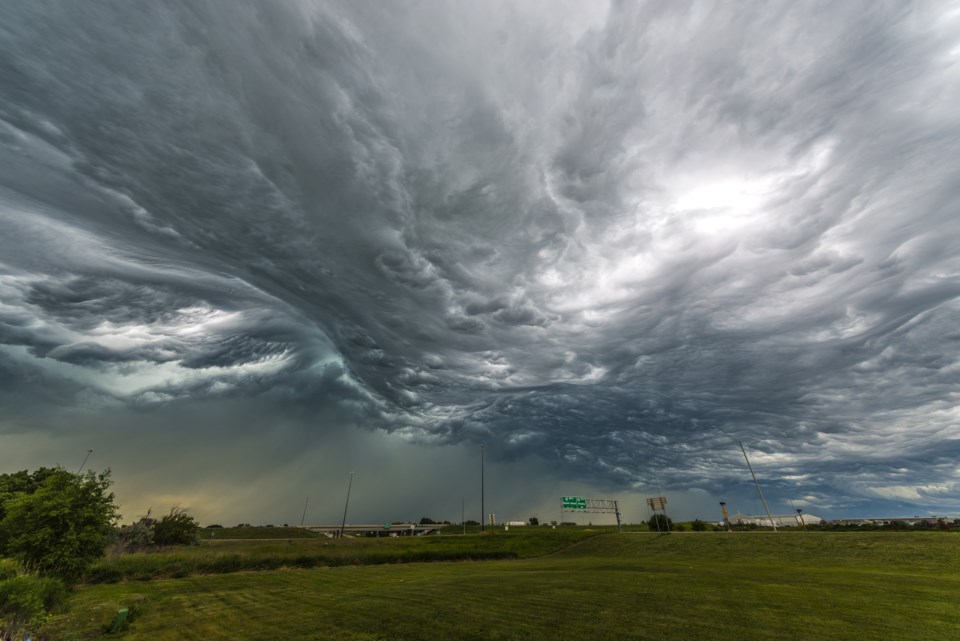
Conditions are favourable for the development of dangerous thunderstorms that may be capable of producing damaging wind gusts, large hail and heavy rain.
Thunderstorms are expected to develop ahead of a cold front beginning this afternoon. Wind gusts up to 100 km/h will be possible.
These thunderstorms will move through the area by early evening.
Very strong wind gusts can damage buildings, down trees and blow large vehicles off the road. Remember, severe thunderstorms can produce tornadoes. Be prepared for severe weather. Take cover immediately, if threatening weather approaches. Lightning kills and injures Canadians every year. Remember, when thunder roars, go indoors!
Severe thunderstorm watches are issued when atmospheric conditions are favourable for the development of thunderstorms that could produce one or more of the following: large hail, damaging winds, torrential rainfall.
The Office of the Fire Marshal and Emergency Management recommends that you take cover immediately if threatening weather approaches.
Please continue to monitor alerts and forecasts issued by Environment Canada. To report severe weather, send an email to [email protected] or tweet reports using #ONStorm.
*************************
Special weather statement in effect for:
• Barrie - Collingwood - Hillsdale
• Orillia - Lagoon City - Washago
• Midland - Coldwater - Orr Lake
Strong winds today.
Strong southwesterly wind gusts of 70 to 80 km/h are expected to develop this afternoon and early this evening, with higher wind gusts likely in thunderstorms. These strong winds are associated with a cold front that will track over the area late this afternoon and early this evening.
Additionally, northwest winds gusting to 60 or 70 km/h are also expected this evening after the cold front passes. Winds will then diminish overnight.
Damage to buildings, such as to roof shingles and windows, may occur. Loose objects may be tossed by the wind and cause injury or damage.
Please continue to monitor alerts and forecasts issued by Environment Canada. To report severe weather, send an email to [email protected] or tweet reports using #ONStorm.
*************************