NEWS RELEASE
GANARASKA HIKING TRAIL ASSOCIATION
*****************
The Ganaraska Hiking Trail Association Inc. is extremely pleased to announce the launch of a new trail guide that will complement the Ondago mobile app maps of the Ganaraska Hiking Trail.
The new maps offer much more detail and are a far cry from what used to be just a “red line on a map.”
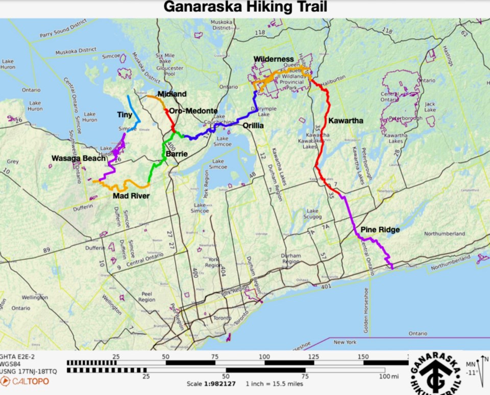
The new trail guide, with downloadable and printable maps and trail descriptions, has now been posted on our website: www.ganaraska-hiking-trail.org.
The maps provide hikers with the option of either a printed map or a mobile device map application, called Ondago. Both offer hikers all the needed detail to be usable as a navigation tool in the field in whichever format they choose, to learn about and enjoy the approximately 500-kilometre-long Ganaraska Hiking Trail from end to end.
The new trail guide maps consist of a series of 33 maps, plus an index map, as well as written trail descriptions (with latitude and longitude co-ordinates). The Ganaraska Hiking Trail website also contains information on how to navigate the trail. See ‘The Trail/Trail Sections with Maps’ for the maps and descriptions, organized by club.
We were very pleased with the work of our cartographer, Lyle Wood of Barrie, and thanks go to the GHTA Mapping Committee members who made the new trail guide possible.
The Ondago mobile app and the associated maps can also be downloaded for free from https://igloocreations.com/en/download to your mobile device, and then search for Ganaraska maps.
Happy hiking!
*****************