Snow squall watch issued for:
- Barrie - Orillia - Midland
- Owen Sound - Blue Mountains - Northern Grey County
- Innisfil - New Tecumseth - Angus
Current details:
Snow squalls are expected to develop this afternoon.
Hazards:
Snowfall accumulations of 20 to 40 cm.
Peak snowfall rates of 2 to 4 cm per hour.
Northwesterly winds with gusts up to 80 km/h developing this afternoon.
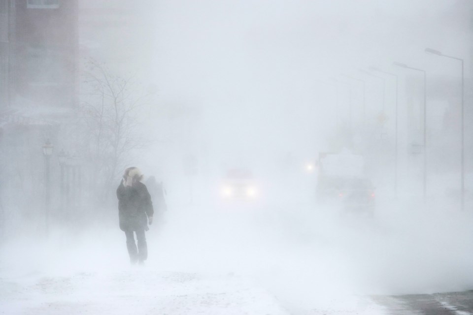
Reduced visibility, to near zero at times, in heavy snow and blowing snow.
Timing:
Beginning this afternoon or early evening through Thursday afternoon.
Discussion:
Snow squalls are expected to develop this afternoon. Significantly reduced visibilities, to near zero at times, are expected due to strong northwesterly wind gusting to 80 km/h. The snow squalls are expected to be the most intense tonight. Snow squalls will weaken and shift north of the area by early Thursday evening.
An upgrade to a blizzard warning may be required should the strong winds persist long enough into this evening particularly for areas near the Lake Huron and Georgian Bay shores.
Travel may be hazardous due to sudden changes in the weather. Visibility may be significantly and suddenly reduced to near zero. Road closures are possible.
Consider postponing non-essential travel until conditions improve.
Please continue to monitor alerts and forecasts issued by Environment Canada. To report severe weather, send an email to [email protected] or tweet reports using #ONStorm.