Postcard Memories is a weekly series of historic postcard views and photos submitted by Marcel Rousseau. Some were previously published by the Orillia Museum of Art and History and in the book Postcard Memories Orillia. Watch for this feature every Saturday morning.
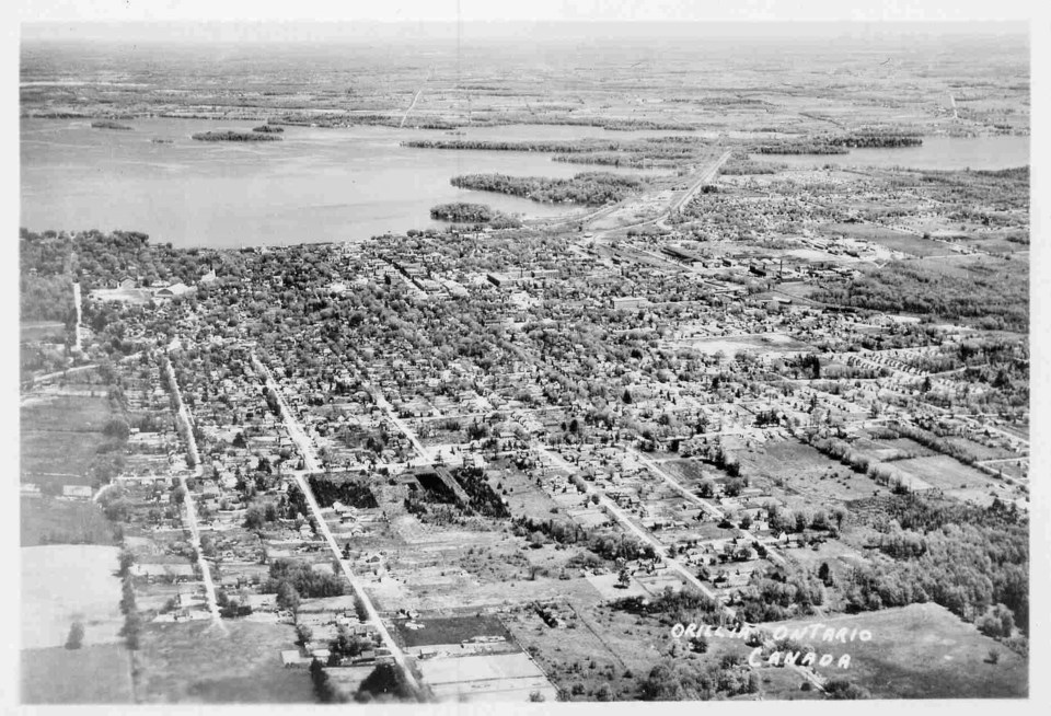
This is a bird's-eye view of Orillia, circa 1950s. Most of the land west of Westmount Drive is still vacant farmland. Arthur Street ends at the bottom left of the picture. The next street on the right is Homewood, extending further into the farmland. The extension of Mary Street is partially developed, however Mississaga Street ended one short block west of Westmount Drive. The new Community Centre, completed in 1952, is visible and the treeless wartime houses on Argyle and Albany streets date this photo card to around 1955.